Cities need to mainstream biodiversity and nature-based solutions into urban planning to maintain and enhance these critical contributions from nature, while at the same time expand to accommodate our growing population and its rapid urban migration. To do this, researchers must first locate and assess cities’ natural assets. Yet in the Global South, this information is often unavailable and inadequate, and cities have limited resources and capacity to collect the needed data. The very nature of these cities poses further challenges. It is nearly impossible to locate and track urban natural assets where informal settlements and systems thrive.
ICLEI, through its INTERACT-Bio project, has pioneered a tool that embraces this informality and provides a solution for fast-growing cities with limited resources whose biodiversity is threatened. Together with the Helmholtz Centre for Environmental Research in Germany, the team developed a rapid appraisal methodology that can identify and locate a city’s key natural areas regardless of the complexities and data gaps. The tool has already produced very useful and inspiring resources in Dar es Salaam, Tanzania.
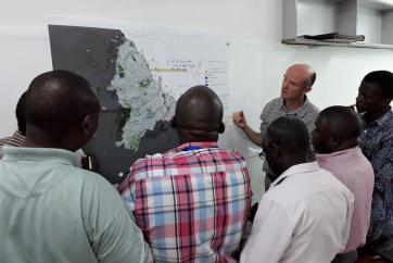
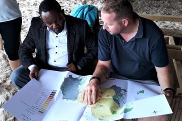
A pioneering method combines the information generated from a remote natural asset mapping process – acquired during the European Space Agency’s Sentinel 2 mission – with local spatial data, scientific studies, and input from Tanzanian experts and city officials. The products generated have therefore been co-created and informed by local knowledge.
The resulting thematic atlas is a compendium of maps that showcases the green open spaces in Dar es Salaam. Planners can now see where wetlands, grasslands, mangroves and woody vegetation is located and how these urban natural assets are important for the city’s economy and the wellbeing of its people. It helps them to make informed decisions around managing and investing in green open space.
The methodology used in developing the thematic atlas is replicable and can be tailor-made to suit cities’ specific needs and priorities. For example, the City of Johannesburg has contracted ICLEI Africa to support it in prioritising its ecosystem services, and in providing this support we are developing a thematic atlas for the city.
Apart from a thematic atlas, the tool can also provide other inspiring outputs. An illustrated poster of Dar es Salaam, for example, provides a beautiful snapshot of the city’s natural assets while the Value of Nature in Urban Life poster demonstrates to all cities around the globe the importance of urban nature.
Once cities know the location and importance of their natural assets, they can champion initiatives to promote urban nature and showcase these initiatives internationally on CitiesWithNature.
CitiesWithNature is a global platform for cities and other subnational governments, their communities and experts, to connect, share and learn from each other in mainstreaming nature into our cities. The founding partners are ICLEI, The Nature Conservancy (TNC) and the International Union for the Conservation of Nature (IUCN), along with supporting bodies such as the Secretariat of the Convention on Biological Diversity (SCBD).
CitiesWithNature has also been endorsed by the SCBD as the official vehicle through which cities and subnational governments can report on their biodiversity commitments and ambitions towards the Sharm El-Sheikh to Kunming Action Agenda for Nature and People and the post-2020 Global Biodiversity Framework.
With this natural asset mapping tool, cities in the Global South can lead the world in creating sustainable, thriving urban areas that contribute to international commitments. It is only one of ICLEI Africa’s innovative urban nature projects. See more on the ICLEI Cities Biodiversity Centre website, or by attending some of our various sessions at the IUCN World Conservation Congress in 2020.
About the author

Adel Strydom is a communications officer at ICLEI Africa


